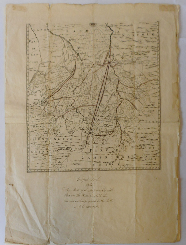
A Map of the Southern part of the Fens

Book Description
Originally issued with Sir Joseph Moore’s great map of 1684, to which it appears to have been intended as an index-map.
Ref Cambridge Antiquarian Society 1903 pp162
The BM disagrees
12. 1705. B.M. A Mapp of the Great Levell of the Fenns called Bedford Levell, with the Rivers and Outfalls thereof to the Sea. [Scale, Miles] 38 [= 358 mm. or 14 1/16 in.] 2 sh. 365×725 mm. or 14¼×28½ in. [London ? 1705 ?]
The Fen Office, which possesses the copper plates from which this map was printed, dates the map at 1663. The sheet covering the southern region is a copy of Dugdale's map (No. 11), but shows Denver Sluice and has two names changed from those on its model. Col. Archer's copy bears a MS. note describing briefly the works to be carried out under the 'Bedford Level Bill' [of 1663], and the positions of these works are marked in red. The sheet covering the northern region and 'the Rivers and Outfalls,' since it shows a much larger area than that covered by No. 11, including both Skegness and Holme in the north, and is engraved in a style characteristic of a later period, seems to be an addition to the southern sheet, made perhaps after 1700. The map is therefore composite; and we may reject Fordham's theory that it was published in 1684 as an index to No. 14, which covers a much smaller area. It has the marginal scale which is characteristic of Nos. 10 to 16. The long and honourable labours of the Earls of Bedford to reclaim the Fenland caused the Great Level to be renamed 'The Bedford Level' when the Bedford Level Corporation was established by Act of Parliament in 1663.
. Manuscript note to lower margin Bedford Level Bill etc ( see BM copy with similar note)
Friends of the PBFA
For £10 get free entry to our fairs, updates from the PBFA and more.
Please email info@pbfa.org for more information
