A New Map of London
Book Description
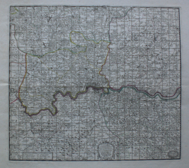
A New Map of London Containing the Towns Gentlemens Houses Villages and Other Remarks Round London, as from London to Windsor, Ware, Chelmsford, the Hope, Tunbridge, Guildford etc. by H Moll, published by Moll, London circa 1750. On paper size 30 by 28 cm. Some hand-colouring. A key gives information on parish churches, villages and hamlets, gentlemen's houses, roads, woods and watermills. Title and Moll's details are in two small decorative cartouches. The map is divided into a series of squares each containing two square miles. Heights are shown in a stylised pictorial manner. The area covered runs from Barkhampsted (sic) across to Chelmsford in the north and from Guildford to Tunbridge in the south. The map probably originated in an atlas published about 1700 and the plate was used for more engravings after this.
Author
Moll
Date
1750
Publisher
Moll
Condition
VG
Friends of the PBFA
For £10 get free entry to our fairs, updates from the PBFA and more.
Please email info@pbfa.org for more information
