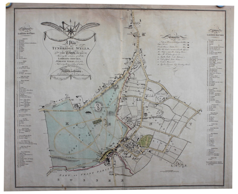
A Plan of Tunbridge Wells in the County of Kent, Showing the Situation of all the Lodging Houses, Publick Walks, Inns and every thing worthy of notice.
Book Description
Other books
If you liked the book you've just seen, you might be interested in other books from the same dealer below.
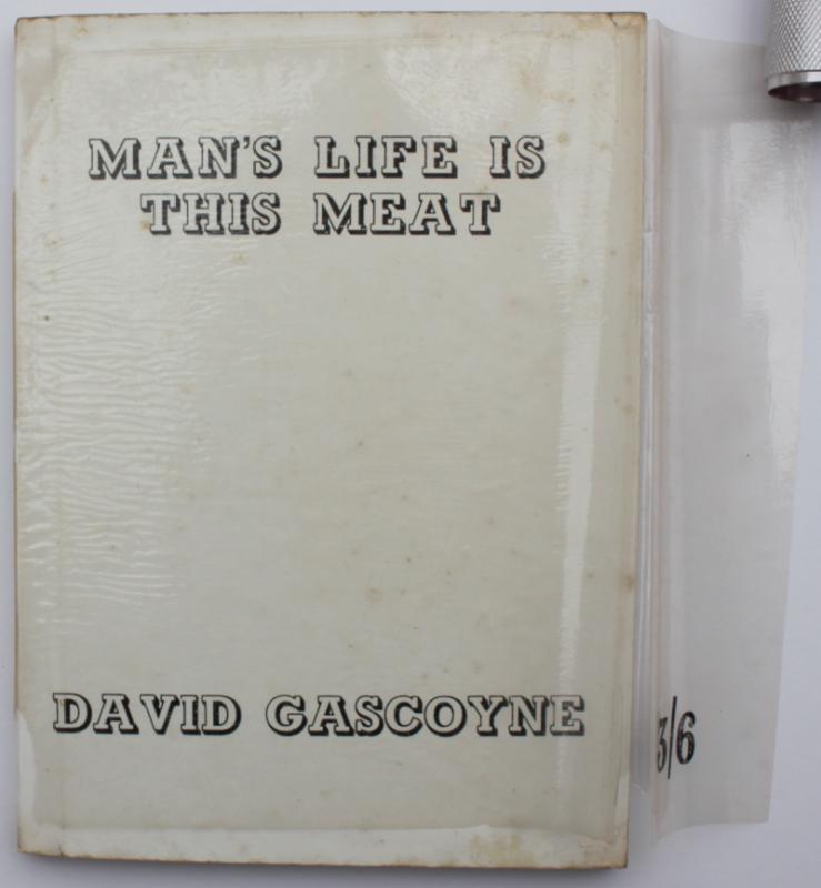
Man's Life is This Meat. In rare dust wrapper.
DAVID GASCOYNE
£750.00
Offered by Michael S Kemp Bookseller
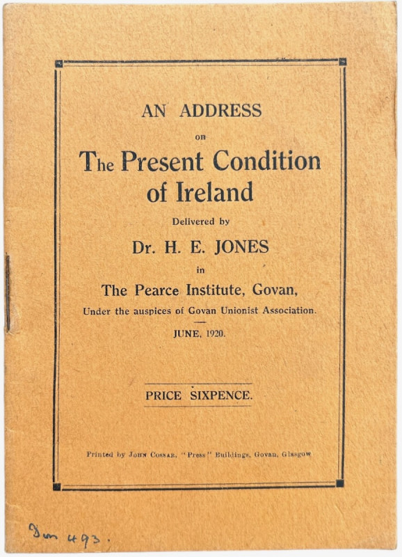
An Address on the Present Condition of Ireland in...
JONES, Dr. H.E.
Glasgow: Printed by John Cossar,
£250.00
Offered by Michael S Kemp Bookseller
AN ESSAY TOWARDS THE HISTORY OF LIVERPOOL 1773
WILLIAM ENFIELD
£650.00
Offered by Michael S Kemp Bookseller
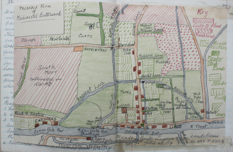
MANUSCRIPT HISTORY OF WEST BUTTERWICK [LINCOLNSHIR...
SYDNEY MORLE
£450.00
Offered by Michael S Kemp Bookseller
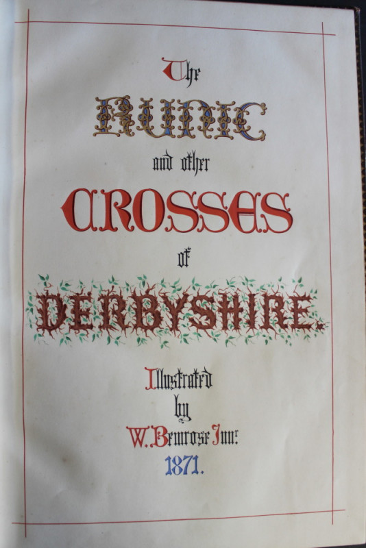
MANUSCRIPT - RUNIC CROSSES OF DERBYSHIRE
WILLIAM BEMROSE
£2250.00
Offered by Michael S Kemp Bookseller
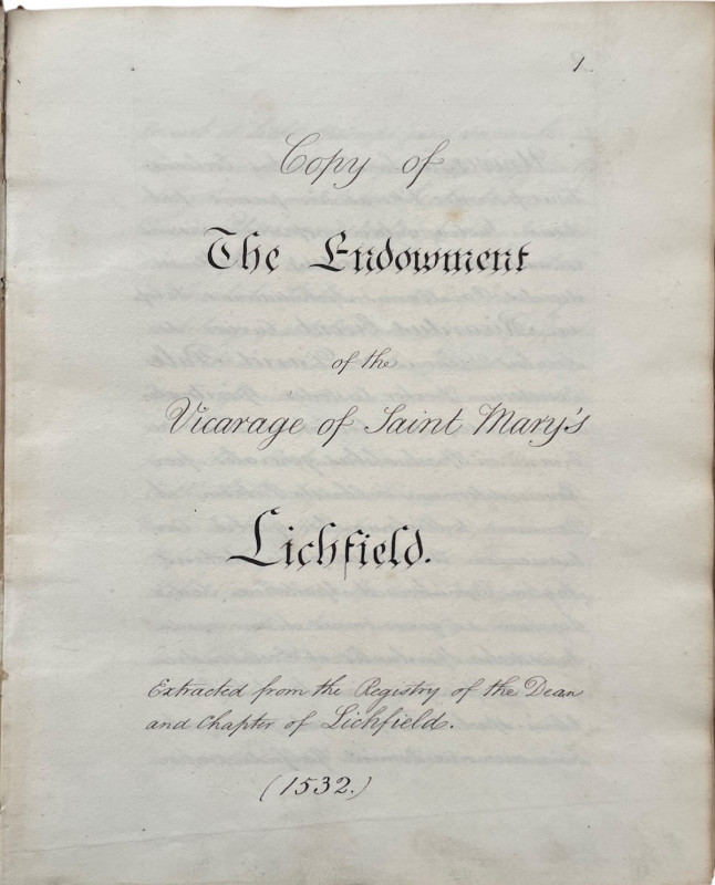
ENDOWMENTS OF THE CHURCH Of SAINT MARY'S, etc
CITY OF LICHFIELD
£450.00
Offered by Michael S Kemp Bookseller
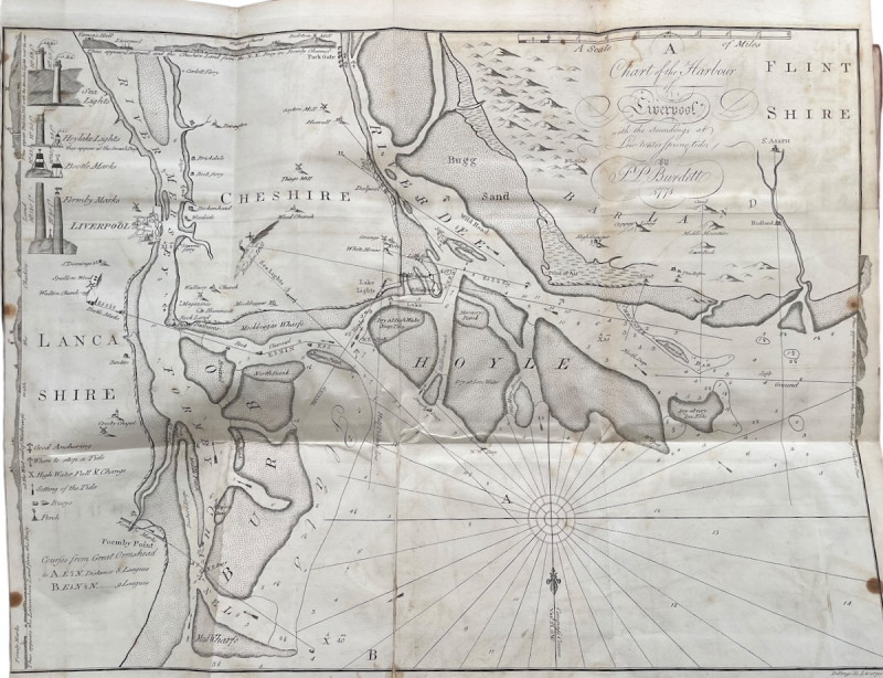
A Plan of Tunbridge Wells in the County of Kent, S...
T.T. BARROW
Tunbridge Wells: T.T. Barrow,
£1250.00
Offered by Michael S Kemp Bookseller

FOUR PHOTOGRAPH AND SCRAP ALBUMS
CHEQUERS - THE HOME OF THE BRITISH PRIME MINISTER
£15000.00
Offered by Michael S Kemp Bookseller
Friends of the PBFA
Please email info@pbfa.org for more information