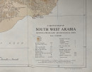
A Sketch Map of South West Arabia showing pre-Islamic Archaeological Sites


Book Description
A Sketch Map of South West Arabia showing pre-Islamic Archaeological Sites, drawn and published by the Royal Geographical Society, London 1976. On paper size 91 by 65 cm. Scale 1:1,000,000. Compiled and with names translated by N St. John Groom. Some colour and a colour-coded key. Sources include works by Doe, Philby, Von Wissman and others. With a key to over 20 geographical and historical features including modern towns and villages, pre-Islamic town sites, settlements overlaid by modern occupation, deserted towns, primary and secondary roads, other pre-Islamic sites, citadels and place names. VG condition.
Author
Groom
Date
1976
Publisher
Royal Geographical Society
Condition
VG
Other books
If you liked the book you've just seen, you might be interested in other books from the same dealer below.
The London Almanack for the Year of Christ 1841
Anon
The London Company of Stationers
£125.00
Offered by Arthur Hook
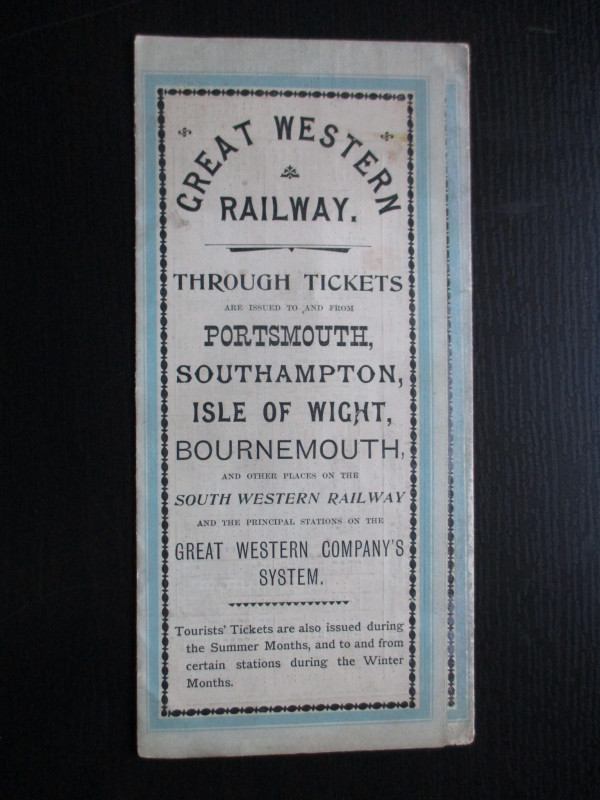
The Great Western Railway of England. Train servic...
GWR
Great Western Railway
£45.00
Offered by Arthur Hook
Map of European Russia and neighbouring states 185...
Sagansan
Avril Frėres
£185.00
Offered by Arthur Hook
The Allied Military Missions in Berlin 1945-48
The Chief of Allied Liaison and Protocol Section
Allied Liaison and Protocol Section
£100.00
Offered by Arthur Hook
Friends of the PBFA
For £10 get free entry to our fairs, updates from the PBFA and more.
Please email info@pbfa.org for more information