A Survey of the City and Suburbs of Bristol survey'd by John Rocque, Land Surveyor


Book Description
Dimensions ( plate area ) are 510mm by 730mm.
Dealer Notes
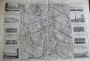
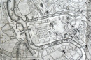
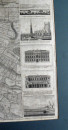
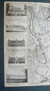
A single sheet reduction of Rocque's 1743 four sheet map of Bristol. Both the 1743 and the 1750 versions are extremely scarce. A superb city plan with extensive detail and decoration, the map being flanked by views of notable local landmarks.
Author
John Rocque
Date
1750
Publisher
John Rocque
Condition
Good margins outside the plate mark, some browning and foxing to small areas, no holes, visible centre fold line.
Pages
Single sheet map
Other books
If you liked the book you've just seen, you might be interested in other books from the same dealer below.
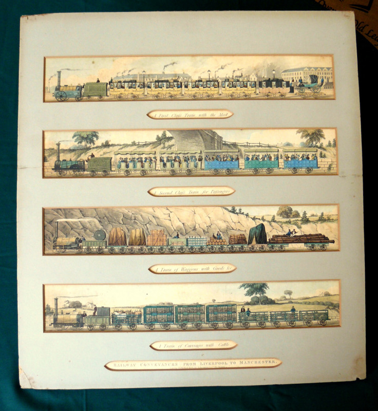
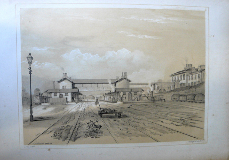
Railway Conveyances from Liverpool to Manchester
Isaac Shaw
Ackermann, London
£450.00
Offered by Steve Liddle
A Survey of the City and Suburbs of Bristol survey...
John Rocque
John Rocque
£1800.00
Offered by Steve Liddle
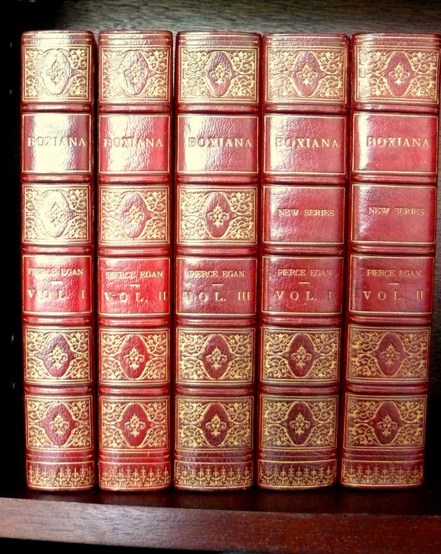
Boxiana; or, Sketches of Ancient and Modern Pugili...
Pierce Egan
London : George Virtue ( Vols. 1, 3, 4 & 5 ), Sherwood, Jones & Co. ( Vol. 2 )
£1850.00
Offered by Steve Liddle
Views on the Manchester and Leeds Railway, Drawn...
Edwin Butterworth
Bradshaw & Blacklock, London & Manchester
£1350.00
Offered by Steve Liddle
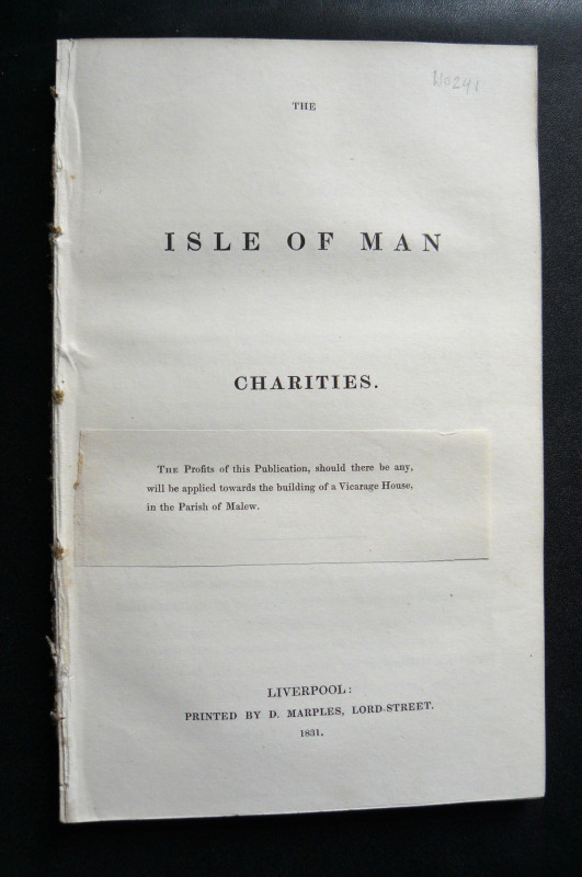
The Isle of Man Charities
McHutchin, J. & Quirk, G.
Printed by D. Marples, Liverpool
£75.00
Offered by Steve Liddle
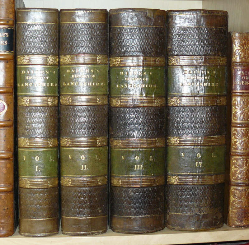
History of the County Palatine and Duchy of Lancas...
Edward Baines
Fisher, Son & Co., London
£750.00
Offered by Steve Liddle
Friends of the PBFA
For £10 get free entry to our fairs, updates from the PBFA and more.
Please email info@pbfa.org for more information