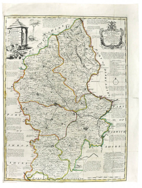
An improved map of the County of Stafford divided into its hundreds.

Book Description
Copper engraving, 695 x 514 mm. hand-coloured in outline.
Dealer Notes
‘The Large English Atlas...’ (so-called from the large paper format employed) was the most successful and important English county atlas of the eighteenth century. Existing county atlases in circulation in the 1740s ultimately owed their origins, or their geography, to Christopher Saxton’s atlas of England and Wales published in 1579. John Hinton commissioned a new series of county maps from two leading English mapmakers, Emanuel Bowen and his son-in-law Thomas Kitchin sr. The first maps for the atlas started to appear in 1749, although the atlas was not actually completed until 1760. The delays reflect the difficulties of financing the cost of draughting and engraving the maps. John Hinton was forced to retire from the project overwhelmed by the costs, and was replaced by John Tinney who was, in turn, forced to take in partners in order to complete the atlas. As part of Hinton’s attempts to finance the scheme, he sold examples ofthe maps of the individual counties as they were completed. This is the first printing of the Staffordshire map, bearing Hinton’s sole imprint - ‘Sold by I. Hinton at the Kings Arms in St. Pauls Church Yard London 1749.’ - which had been replaced by the time the full atlas appeared.
These early printings are very desirable, partly because of their rarity but also they are invariably strong dark impressions that compare favourably with late impressions, which are much paler because of the number of prints taken from the plate.
This is a very good example, in contemporary outline colour; this example has unusual folds which show that it was inserted into an unidentified book, rather than having been bound into the ‘Large English Atlas’.
Author
BOWEN, Emanuel.
Date
1749
Publisher
London, John Hinton
Friends of the PBFA
For £10 get free entry to our fairs, updates from the PBFA and more.
Please email info@pbfa.org for more information
