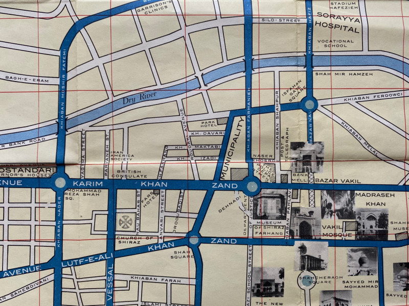
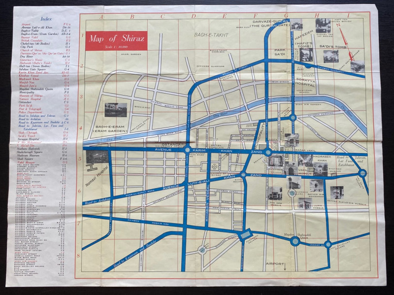
Map of the city of Shiraz circa 1960


Book Description
Map of the city of Shiraz. On paper size 58 by 44 cm. Scale 1:10,000. Published as a guide for tourists in English circa 1960. Colour. Includes small vignettes or images of various landmarks. Covers an area from Bagh-e-Taleht and the Quran Gate in the north to Namazi Hospital in the west, and from Abu Zara Square in the east to an area beyond Shah naz Square and Shah Dai-Ollah Square in the south. Includes a detailed key to 41 features including Vakil Mosque, Hafizieh Stadium, Soraya and Nazami hospitals, Sa’ di’s Tomb, the police department, Governor’s House and Post and Telegraph Offices. There is a second key to over 50 individual streets. Has been folded. Good to VG condition
Author
Anon
Date
1060
Condition
VG
Friends of the PBFA
For £10 get free entry to our fairs, updates from the PBFA and more.
Please email info@pbfa.org for more information
