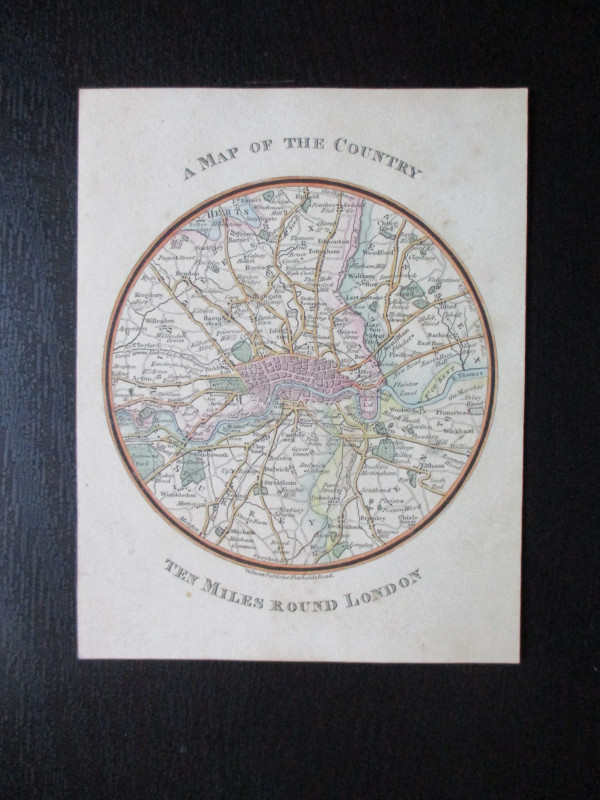
Map of the Country Ten Miles Around London

Book Description
Map of the Country Ten Miles Around London published by Snow, London circa 1820. A circular map, 10 cm. in diameter, set in a 14 by 11 cm. card frame. Hand-coloured. Covers an area from Enfield in the north across to Croydon in the south and from Ealing in the west to Ilford and Plumstead in the east. Hand-coloured. VG condition.
Author
Snow
Date
1820
Publisher
Snow
Illustrator
Snow
Condition
VG
Friends of the PBFA
For £10 get free entry to our fairs, updates from the PBFA and more.
Please email info@pbfa.org for more information
