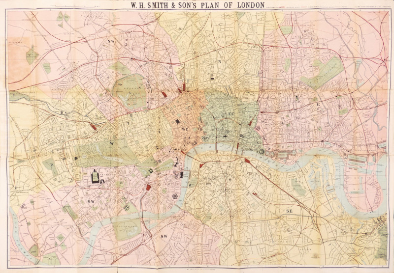
W.H. Smith & Son's Plan of London


Book Description
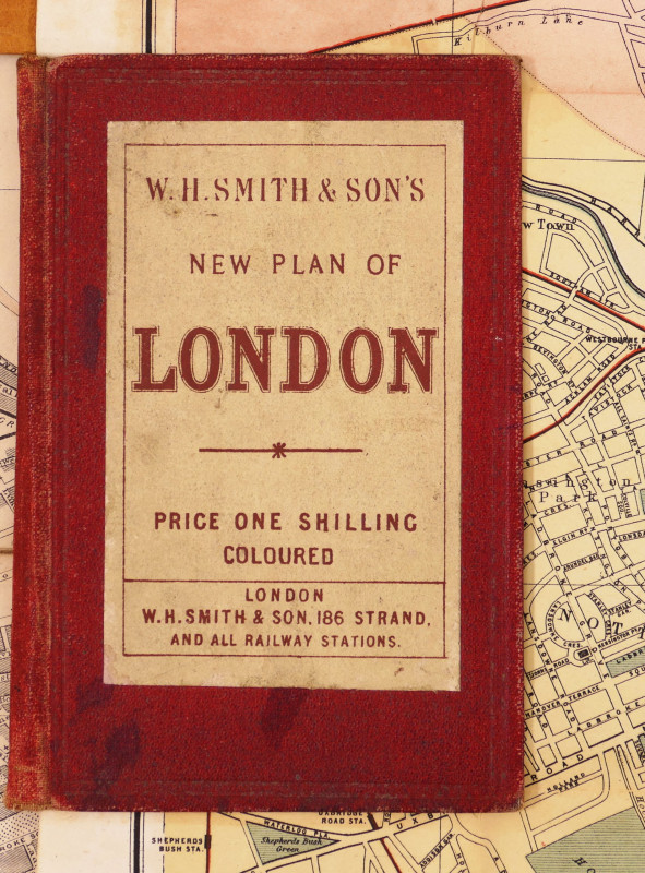
original hand-coloured plan, 565 x 815 mm. (22 1/4 x 32 1/8 in), a few repaired splits and slight browning on old folds, a repaired tear lower left, folding into contemporary red cloth boards with publisher’s label pasted on, titled here as W.H. Smith & Son’s New Plan of London, and priced at One Shilling Coloured, 8vo, [Hyde 155 (before 1)]
Dealer Notes
a very early state of this later Victorian plan of central London, extending from Upper Holloway to Stockwell, and from Shepherds Bush to East India Dock, the whole colour-coded in pale yellow, pink and green by postal district, with parks and garden squares also picked out in green, and public buildings in heavy black. Tramways, underground and overground railways are also delineated, with their key in the upper right margin beside the bold central title.
This plan clearly derives from Smith’s earlier Plan of London from c.1872 (Hyde 147), but which only extended as far west as Kensington, and south as far as Camberwell. They even share the cover title of ‘New Plan of London’, and price of one shilling, where the larger plan is otherwise always priced at 2/-. But, unlike Hyde’s described first state of this later plan, which he gives the nominal issue date of c.1875, there is no sign of Liverpool Street Station, which opened in 1874, only a dotted line beside Broad Street Station. The Metropolitan line is similarly only dotted in beyond Moorgate, where the presumed first state shows both Liverpool Street and its Metropolitan line connection.
Other points of interest in a map of this period include the presence of the Horticultural Society’s Gardens in the ‘Albertopolis’ area of South Kensington, laid out in the 1860s, but which struggled for viability in the evolving development of the area that sought to build on the legacy of Prince Albert’s Great Exhibition, and was eventually replaced in 1888 by the Natural History and Science Museums, and Imperial College. Similarly, over to the east, is the absence of Tower Bridge, the construction of which commenced in 1886, and the presence of its predecessor, the Tower Subway, which existed between 1870 and 1898.
Author
Smith (W.H., & Son) (Publisher)
Date
[c.1873]
Publisher
W.H. Smith & Son
Friends of the PBFA
For £10 get free entry to our fairs, updates from the PBFA and more.
Please email info@pbfa.org for more information
