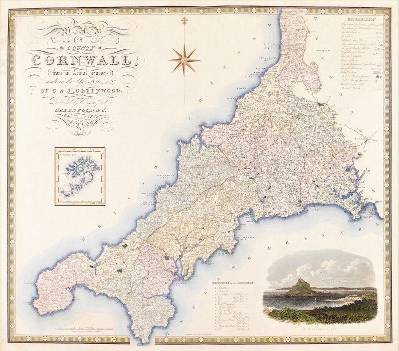
Map of the County of Cornwall from an Actual Survey made in the Years 1826 & 1827
Book Description
engraved map by John Dower, with original hand-colouring, 625 x 720 mm. (24 5/8 x 28 3/8 in), central vertical fold, three repaired tears in the upper margin
Dealer Notes
county map with a vignette view of St Michael’s Mount, lower right, an inset chart of the Scilly Isles centre left, with the elaborately lettered title above, a compass rose upper centre with the key, or Explanation, upper right, the reference list of ‘Hundreds’ lower centre
Author
Greenwood (Christopher and John)
Date
1829
Publisher
Greenwood & Co
Friends of the PBFA
For £10 get free entry to our fairs, updates from the PBFA and more.
Please email info@pbfa.org for more information
