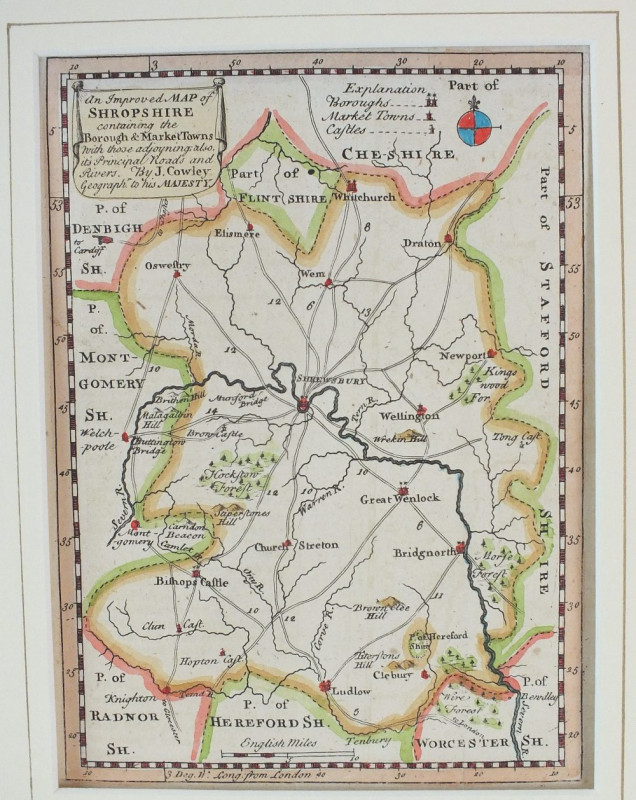
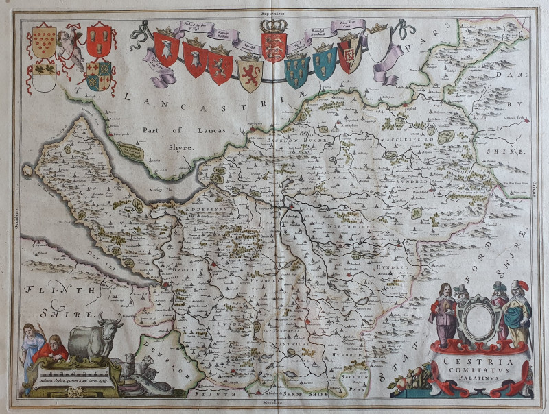
An Improved Map of Shropshire
Book Description
Other books
If you liked the book you've just seen, you might be interested in other books from the same dealer below.
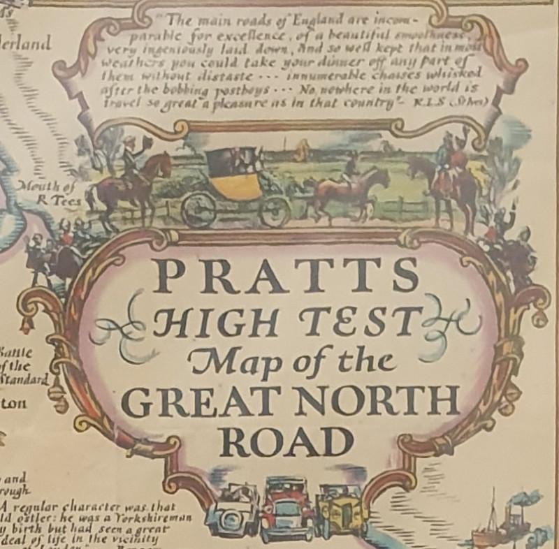
Pratts - High Test Map of the Great North Road
Pratts/Anglo-American Oil
£195.00
Offered by Alastor Rare Books
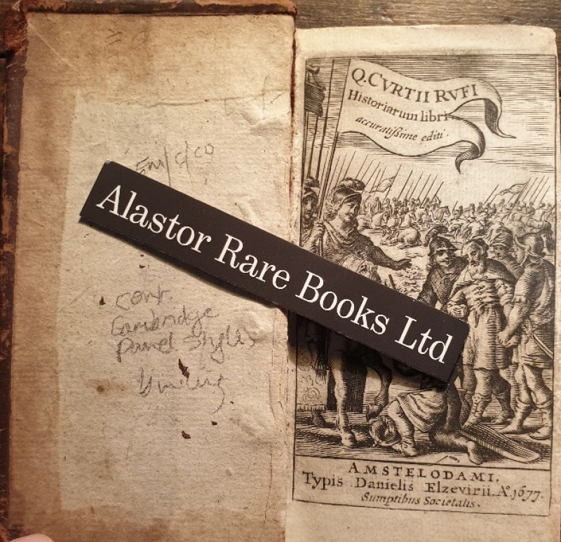
[A ROMAN HISTORY OF ALEXANDER THE GREAT IN A CONTE...
Rufius, Q.[uintus] Curtius. Historiarum Libri.
Amstelodami i.e. Amsterdam: Typis Danielis Elzevirii,
£100.00
Offered by Alastor Rare Books
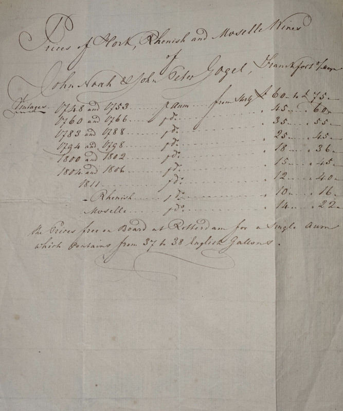
[AN MS PRICE LIST FOR VINTAGE 18TH C GERMAN WHITE...
[Noah & Gogel].
£30.00
Offered by Alastor Rare Books
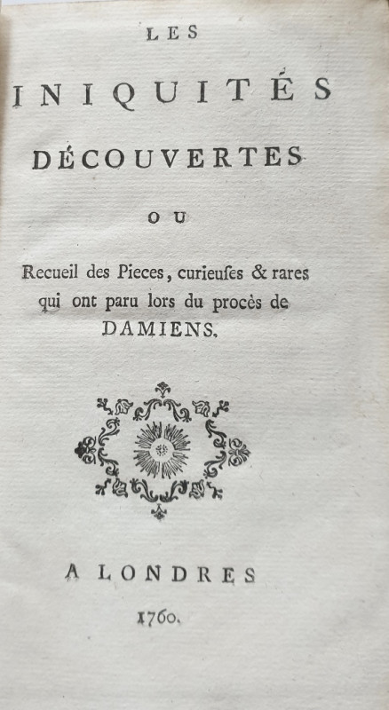
[THE ATTEMPTED ASSASSINATION OF LOUIS XIV].
[Grosley, Pierre Jean].
A Londres i.e. Paris: [s.i.],
£100.00
Offered by Alastor Rare Books
[AN ELIZABETHAN PROPERTY DOCUMENT - 1573].
[Final Concord Counterpart Property Conveyance For Property In Sutton].
£120.00
Offered by Alastor Rare Books
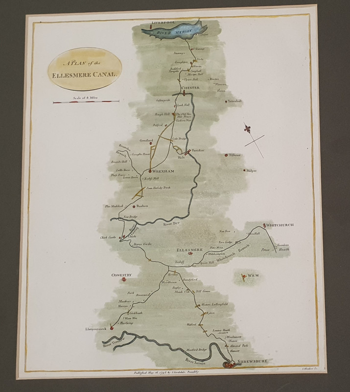
CANANL MAP: Plan of the Ellesmere Canal
Joseph Mutlow
John Stockdale, London
£75.00
Offered by Alastor Rare Books
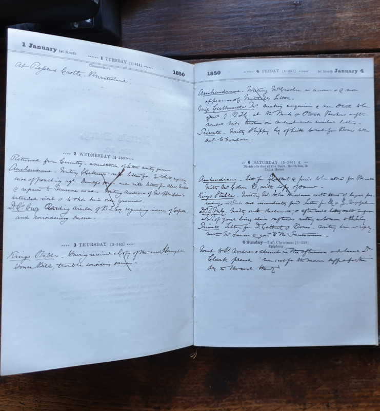
[Manuscript Journal].
[DIARIES FROM A SCOTTISH FAMILY - TWO BROTHERS]. Cathcart family, John E. & Robert. [Manuscript Journal].
£250.00
Offered by Alastor Rare Books
Friends of the PBFA
Please email info@pbfa.org for more information