Large Parish Map Cornwall 1875

Book Description
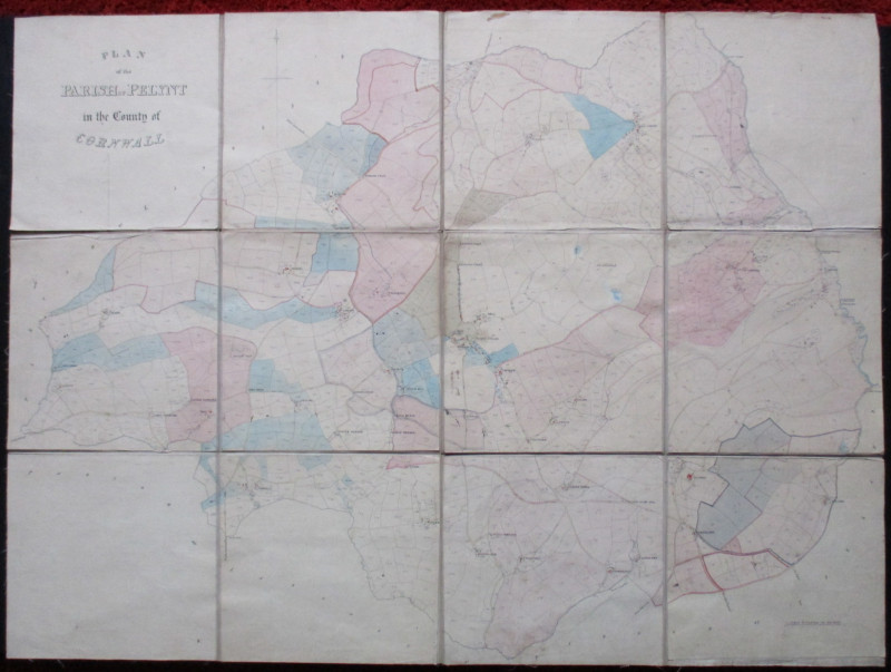
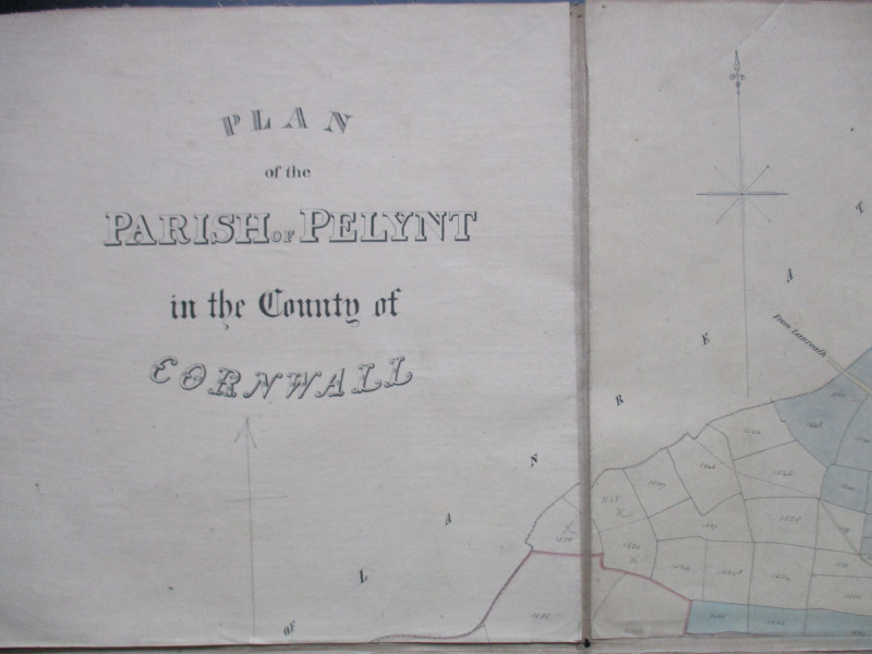
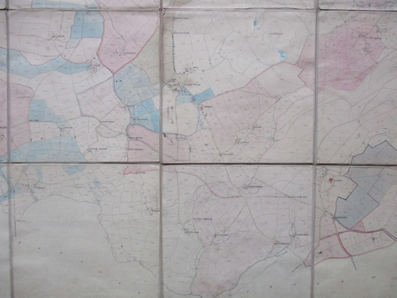
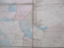
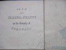
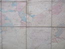
Plan of the Parish of Pelynt in the County of Cornwall. On folding linen in 12 sections, size 103 by 75 cm. Scale 8 chains to the inch. No details of publisher or date but the style and content would suggest circa 1875. A very detailed map, with field boundaries and all settlements shown and fields individually numbered. Some hand-colouring. Includes a compass rose. Occasional small ink stains which might relate to the hand-colouring. Good condition with no loss or tears.
Author
Anon
Date
1875
Condition
Good
Other books
If you liked the book you've just seen, you might be interested in other books from the same dealer below.
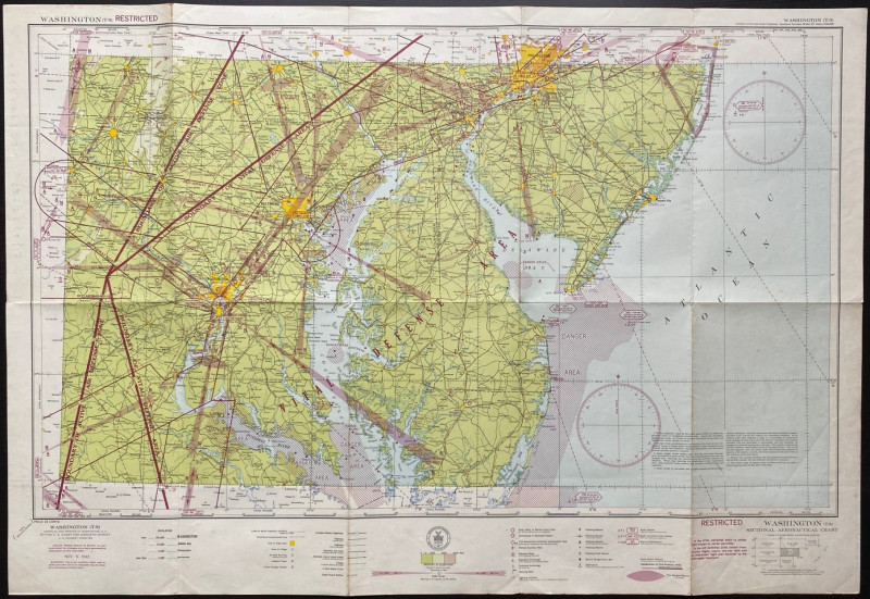
Map of Washington Air Defence Zone 1942
Colbert
US Coast and Geodetic Survey
Reserved
Offered by Arthur Hook
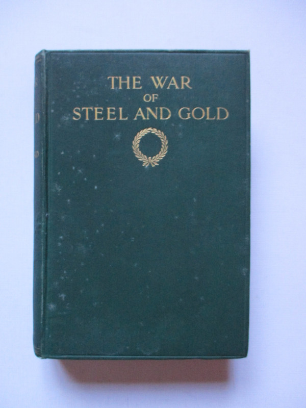
The War of Steel and Gold- Bertrand Russell Signed...
Brailsford
Bell
£450.00
Offered by Arthur Hook


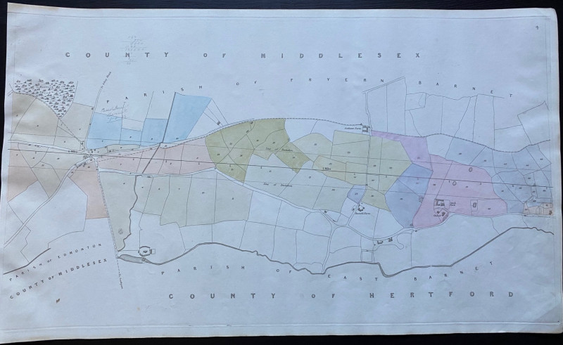
Map of Edmonton and Hollick Wood to Fryern Barnet...
Rennie
Arrowsmith
£35.00
Offered by Arthur Hook
Friends of the PBFA
For £10 get free entry to our fairs, updates from the PBFA and more.
Please email info@pbfa.org for more information