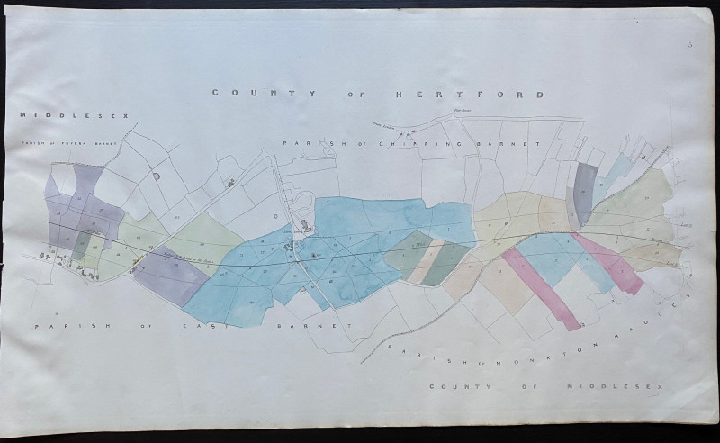
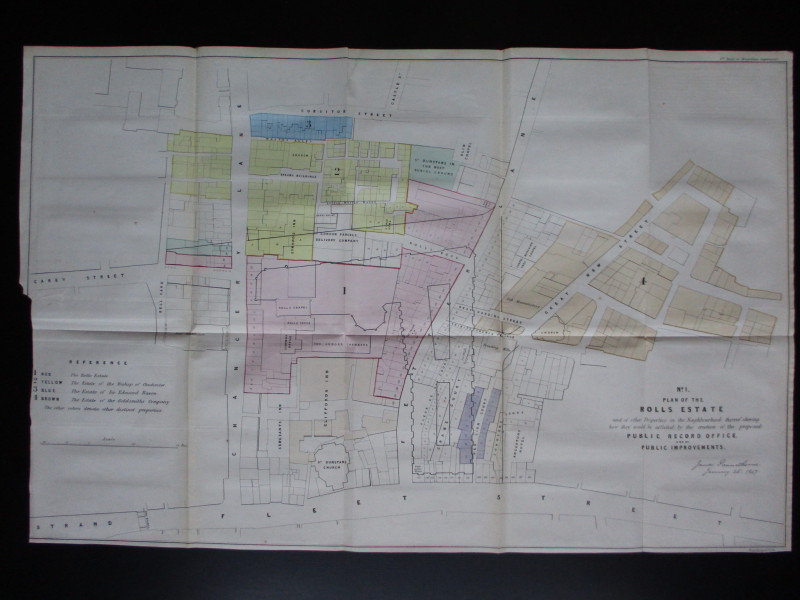
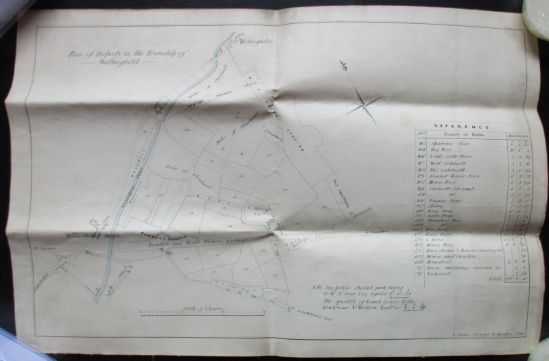
Map of Fryern Barnet to the tunnel near Chipping Barnet 1845


Book Description
Maof an area from Fryern Barnet to the tunnel near Chipping Barnet including Lions Down. With individual house sand part of the road to London. One of a series of plans and sections for a railway from London to Manchester by Rennie, Rastrick and Remington printed and published by Arrowsmith 1845. On a scale of 6 chains to the inch or 14 inches to the mile on stiff paper size 73 by 43 cm. With original hand-colouring. A detailed map on a large scale and a fascinating example of early Victorian railway planning. VG condition.
Author
Rennie
Date
1845
Publisher
Arrowsmith
Condition
VG
Other books
If you liked the book you've just seen, you might be interested in other books from the same dealer below.
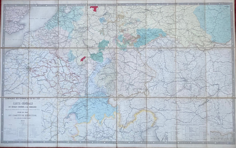
Railway Map of France, Germany, Holland, Switzerla...
Letellier and Potiquet
Compagnie des Chemins de Fer de l’Est
£175.00
Offered by Arthur Hook
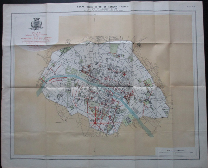
Four Plans for the development of the Central Lond...
Pennethorne
Hansard
£125.00
Offered by Arthur Hook
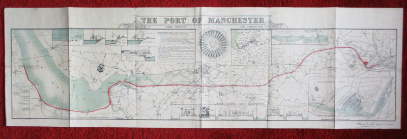
Map of the Port of Manchester & Ship Canal 1902
Falkner
Manchester Ship Canal
£125.00
Offered by Arthur Hook
Friends of the PBFA
For £10 get free entry to our fairs, updates from the PBFA and more.
Please email info@pbfa.org for more information