SOUTHWARK STREET PLAN 1768
Book Description
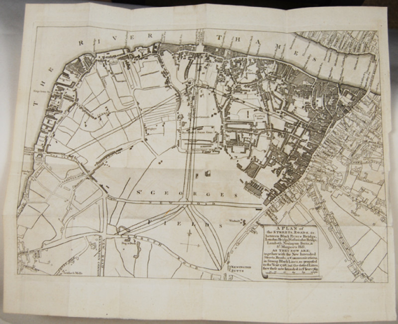
A plan of the streets, roads, &c. between Black Fryers Bridge, London Bridge, Westminster Bridge, Lambeth, Newington Butts, & St. Margarets Hill, as they now are; Together with the new intended streets, ... as proposed in 1768 ... the dotted lines show these now intended in... 1769. Engraved plan 270 x 370 mm (to the plate mark). A clean and crisp copy with good margins. Old folds, presumed from a periodical.
This is different to the similar plan published in the London Magazine. The legend and scale of feet are on a scroll, not a monument. There is no inset of Black Fryers Bridge. Additional streets are shown and named in all except the NW corner of the plan.
Author
ANON.
Date
1768
Friends of the PBFA
For £10 get free entry to our fairs, updates from the PBFA and more.
Please email info@pbfa.org for more information
