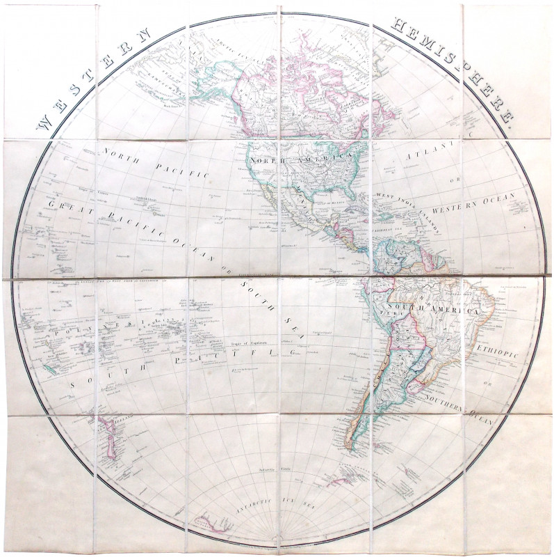
Western Hemisphere.
Book Description
A large folding engraved map, coloured, sectionalised on linen and folding into original boards, cartographer’s label to upper board, faded to spine.
Dealer Notes
An excellent map, showing the Americas in toto, the eastern tip of Asia with the Behring Strait, New Zealand and Polynesia, Greenland at the top and the Azores and Cap Verde Islands to the east. The information relating to the Arctic shows Cape Parr, named for Alfred Parr of the British Arctic Expedition under George Nares (1875-6). The South Shetland Islands and Graham Land are shown to the south, as are the Balleny Islands and ‘South Victoria’ (Victoria Land).
Author
[Map.]
Date
1888
Binding
Original boards
Publisher
London: James Wyld
Condition
See description
Friends of the PBFA
For £10 get free entry to our fairs, updates from the PBFA and more.
Please email info@pbfa.org for more information
